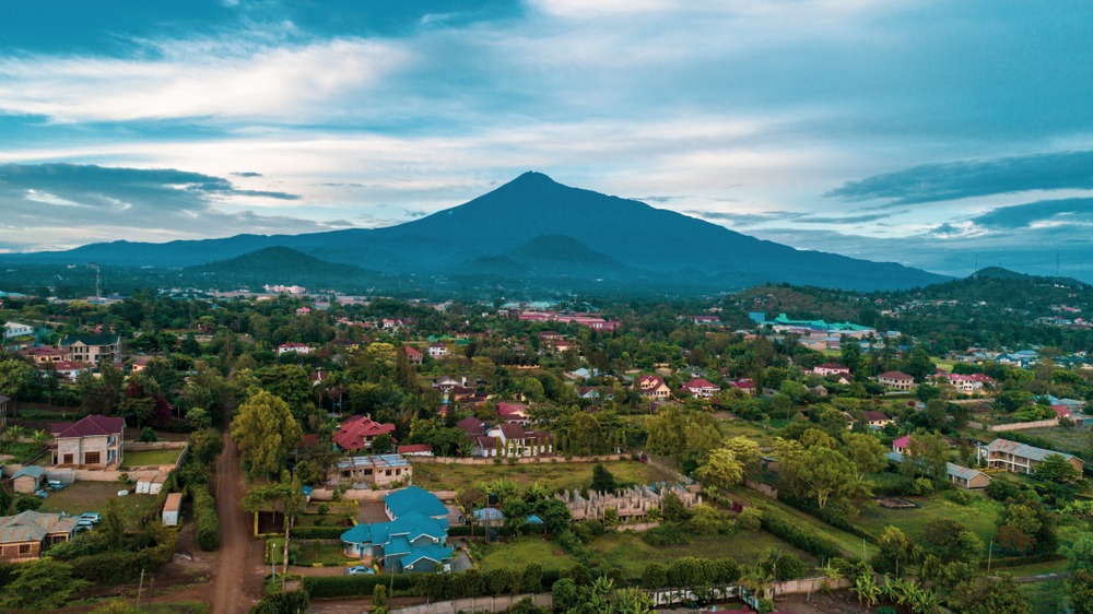
The Arusha National Park spans 137 km² around Mount Meru, Africa's fifth highest peak at 4,566 meters. Located in northeast Tanzania, near the city of Arusha, this compact park brings together three contrasting environments: a forested volcanic crater, a forested mountain and a string of alkaline lakes frequented by pink flamingos.
Why visit Arusha National Park
Often overshadowed by the Serengeti or Ngorongoro, Arusha National Park offers a different experience from classic safari. Its small size allows you to explore it in a single day, on foot or by 4x4, and the diversity of its landscapes — rainforest, highland savanna, salt lakes, volcanic crater — concentrates accessible wildlife without the long trails of the larger northern parks.
The park also plays a strategic role for trekkers: climbing Mount Meru serves as an altitude acclimatization phase before tackling the nearby Ngorongoro or Kilimanjaro.
History and name of the park
The park takes its name from the Warusha community, an agropastoral people long settled on the slopes of Mount Meru. Created in 1960, it was initially classified as a protected site around Meru and the extinct volcano Ngurdoto, whose crater several kilometers in diameter is one of the highlights of a visit today.
The region also concentrates several major sites in northern Tanzania: the Olduvai Gorge, the Ngorongoro crater and the Kilimanjaro massif form a cohesive ensemble that can be linked on a single circuit.
What to see and do in the park
Three distinct zones
The park divides into three sectors with very different atmospheres:
- Ngurdoto crater: caldera of an extinct volcano, observable from several viewpoints on its rim. Its swampy basin is home to buffalo and warthogs.
- Mount Meru: forested massif peaking at 4,566 m, crossed by hiking trails.
- Momela lakes: seven alkaline lakes with varying hues, frequented by a significant population of pink flamingos.
Climbing Mount Meru
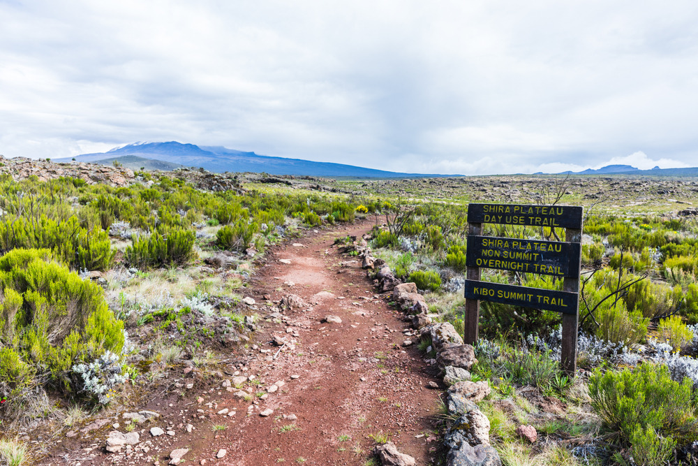
The ascent is usually done over 3 or 4 days, led by an armed guide due to the presence of buffalo. The itinerary traverses rainforest layers, alpine moorland and the summit ridge. On clear days, the peak offers views of Kilimanjaro's silhouette on the horizon. Many trekkers then continue to Kilimanjaro, with the effort on Meru serving as acclimatization.
At the foot of the massif, the Jekukumia River winds through the forest and provides an appreciated rest spot.
Wildlife and animal observation
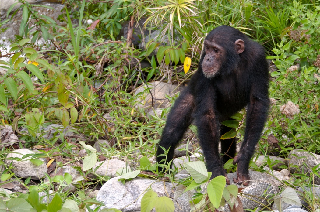
The rainforest at the entrance is home to several primate species, including the black and white colobus, recognizable by its long white tail. The park is also a renowned birding site, with approximately 400 species recorded: pelicans, crowned eagle, ibis, turaco, kite, hornbill.
Near water points and marshes, buffalo, hippopotamuses and warthogs are regularly observed. The Momela lakes welcome pink flamingos. Giraffes, zebras, antelopes and leopards complete the picture, while lions and elephants are present but rare.
Practical information
- Area: 137 km² (one of Tanzania's smallest national parks)
- Activities: 4x4 safari, guided hiking, canoeing on Momela lakes, multi-day Meru trek
- Duration of visit: one day for the essentials, 3 to 4 days for the complete ascent of Meru
- Fees: entrance fees apply (rates set by park authorities, verify before departure)
- Guidance: park ranger guide mandatory for hikes and ascent
When to visit the park
The park can be visited year-round, but the dry season, from late June to October, remains the most favorable period: trails are passable, skies are clear for views of Kilimanjaro from the heights of Meru, and wildlife observation is easier around water points.
The short rainy season (November) and the long wet season (March to May) green up the landscapes but complicate the ascent of Meru and certain trails.
How to get there
The main entrance is located approximately 25 km northeast of Arusha city, less than an hour's drive away. Most visitors access it by private vehicle or 4x4 hired through a local agency, the most practical option for combining the visit with other northern parks.
Kilimanjaro International Airport (JRO), located about 60 km away, is the nearest air entry point.
To combine in the region
- Arusha: essential stopover city for northern circuits, logistical base for safaris.
- Ngorongoro Conservation Area: famous crater and exceptional ecosystem a few hours' drive away.
- Lake Natron: spectacular alkaline lake at the foot of Ol Doinyo Lengai, accessible from Arusha.
- Boma Natural History Museum: in Arusha itself, to understand human evolution and regional wildlife.
Frequently asked questions
Frequently asked questions
One day is enough to tour the three main zones by 4x4 and see the essential wildlife. Allow 3 to 4 additional days if you wish to complete the full ascent of Mount Meru.
Many circuits include it as an introductory or acclimatization day before continuing to Tarangire, Ngorongoro and the Serengeti. Its proximity to Arusha makes it a logical stop.
Yes, it's even one of the few national parks in Tanzania that permits hiking, provided you're accompanied by an armed ranger. It's an excellent way to experience the forest and Momela lakes.
Yes. At 4,566 m, Meru allows gradual altitude acclimatization, which significantly improves chances of success on Kilimanjaro attempted immediately after.
Their presence is most pronounced during the dry season, from June to October, when water levels and salt concentration favor their stay.
Prepare your trip to Tanzania
Arusha National Park naturally fits into an itinerary combining northern safaris and altitude trekking. To build a custom trip including this stop, consult our Tanzania journeys.