Shira Plateau
Shira Plateau
A remnant of a collapsed volcano at 3,500-3,962 m, Shira Plateau is crossed by the Lemosho and Shira routes on Kilimanjaro's ascent.
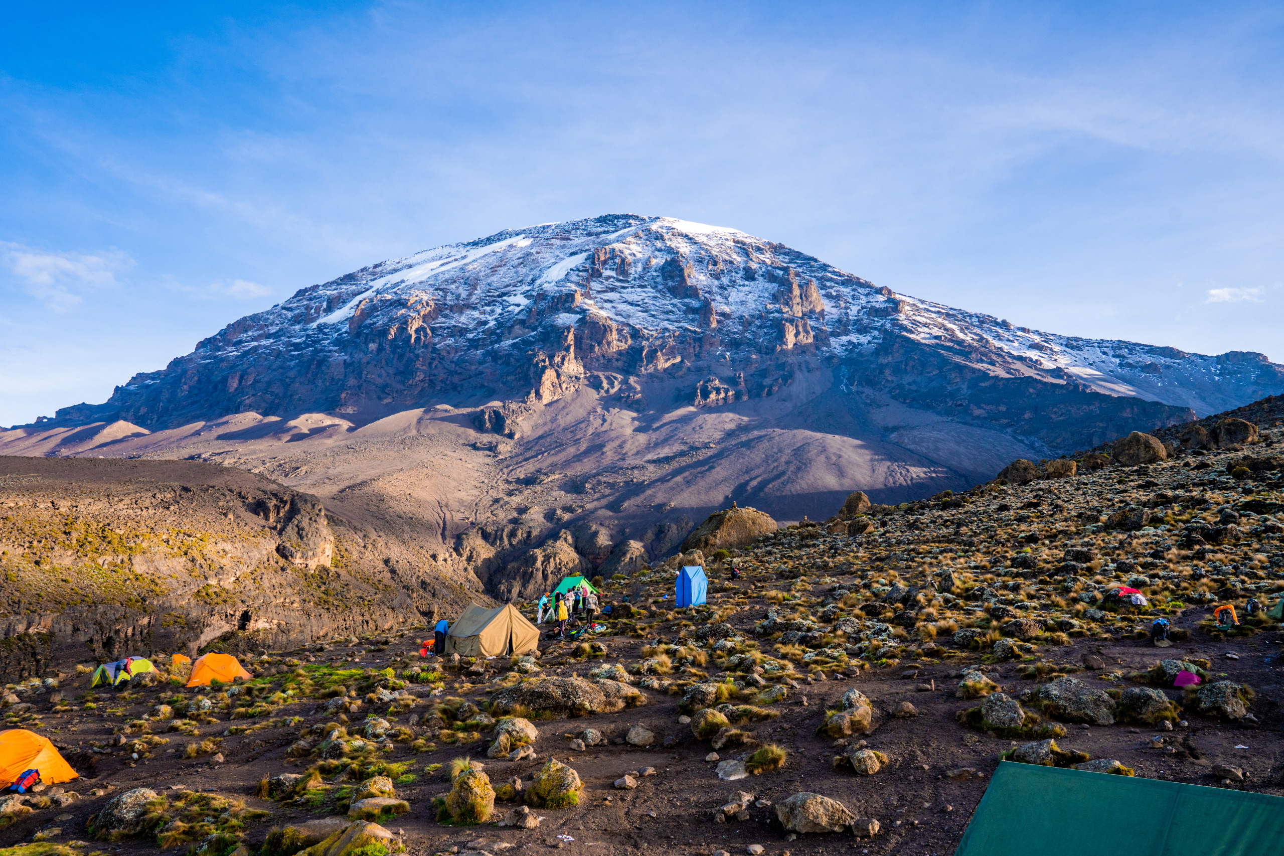
On the western flank of Kilimanjaro, Shira Plateau stretches across roughly 62 km² between 3,500 and 3,962 meters in elevation. A remnant of an ancient collapsed volcano, traversed by several routes up Africa's highest peak, it combines volcanic geology, alpine flora, and direct views of Kibo's dome.
Why visit Shira Plateau
The plateau appeals to three types of travelers. Hikers find here a major stage of Kilimanjaro's ascent, with gradual climbing favorable to acclimatization. Geology enthusiasts observe traces of a collapsed caldera, eroded lava flows, and obsidian outcrops. Naturalists traverse an alpine heath zone populated by plants adapted to altitude, such as lobelias and giant groundsels.
Unlike routes that skirt the massif from the south, itineraries passing through Shira offer a transverse crossing of Kilimanjaro, with sweeping panoramas of Mount Meru to the west and Mawenzi's pyramid to the east.
Geological and cultural history
Shira Plateau is one of three volcanic cones composing the Kilimanjaro massif, along with Mawenzi and Kibo. The Shira volcano once peaked above 4,877 meters before its activity ceased roughly 500,000 years ago. The collapse of the caldera and erosion left a vast plateau bounded by an abrupt ridge to the west.
Kilimanjaro's slopes are historically the territory of the Chagga people. The plateau contains obsidian deposits, a glassy volcanic rock they used to craft arrowheads. Several of these artifacts have been found in plateau caves, indicating ancient human presence at these heights.
What to see on the plateau
The landscape alternates between deep valleys, eroded lava flows, and isolated rock formations. Four points particularly mark the crossing.
Shira Cathedral
On the south rim of the ancient caldera, this ridge culminates at 3,872 meters at the point called Cathedral Point. Its name stems from a translation error from the German Dom: the silhouette evokes a Gothic spire more than a dome.
Shira Needle
West of the Cathedral, this solitary rocky peak is the result of erosion of a volcanic chimney. It serves as a visual landmark on the plateau.
Shira ridge
This steep line bounds the plateau on its western flank, between 3,700 and 4,200 meters. It includes two named peaks, Klute Peak and Johnsell Point, the latter marking the plateau's highest point.
Lava Tower and surroundings
Beyond the plateau, toward Kibo, Lava Tower (4,630 m) constitutes a classic acclimatization stage on the Lemosho and Machame routes.
Flora and fauna
The plateau lies within Kilimanjaro's alpine heath zone. Vegetation includes lobelias and giant groundsels, giant heathers, tufts of tall grasses, and everlastings, all adapted to nocturnal cold and low atmospheric pressure.
Wildlife is discreet but present. Buffalo, harness antelope, and eland frequent the northern wetlands, where stagnant water feeds several streams. Elephants occasionally cross the plateau, as attested by carcasses found at altitude. Lower down, in peripheral plains and forests traversed by access trails, one observes zebras, wildebeest, giraffes, and black-and-white colobus monkeys.
When to visit
The plateau's climate is cool and dry. Count on roughly 10 °C during the day and temperatures below freezing at night. Fog is frequent and can resemble persistent drizzle.
The best period spans June through October: trails are passable, skies often clear, good visibility of Kibo. A second window opens from December through February, with somewhat less stable conditions. Rainy seasons (March-May and November) are best avoided for climbing.
How to get there
The plateau is accessible only on foot, as part of a Kilimanjaro ascent led by a certified guide. Three park routes traverse it from the west:
- Lemosho Route: the most used for reaching Shira. It climbs gradually through forest then heath, crosses the plateau, and reaches Lava Tower before continuing toward Barranco, Karanga, and Barafu.
- Shira Route: the original trail, now rarely used. It begins directly at altitude above the forest, which hampers acclimatization. It mainly serves as a 4x4 support track to Shira 2 camp.
- Northern Circuit: a long route that passes through the plateau before circling Kibo from the north.
The Machame route, more popular, skirts the plateau from the south without crossing it. Descent is generally made via the Mweka route.
Three camps punctuate the crossing: Simba Camp (3,595 m), Shira Camp 1 (3,505 m), and Shira Camp 2 (3,810 m).
Practical information
Access to the plateau is mandatory within an organized Kilimanjaro trek:
- Guidance: guide certified by the national park, porters and cook required.
- Permits: Kilimanjaro National Park entrance fees, camping fees, and various taxes included in agency packages. The total cost of an ascent remains high due to these regulated fees.
- Duration: 6 to 8 days for a complete ascent via Lemosho or Shira, with plateau crossing during the first days.
- Equipment: technical clothing for sub-zero temperatures, cold-weather sleeping bag, headlamp, reinforced sun protection.
- Health: serious physical preparation and prior discussion with a doctor on altitude sickness prevention.
Nearby attractions
Kilimanjaro's ascent combines easily with other stages in Tanzania:
- The Barranco Hut Camp, the next stage on Lemosho and Machame routes before Kibo's final push.
- The Great Rift Valley, which structures the region geologically.
- The Natural History Museum of Boma in Arusha, useful in preparation or recovery.
- The Amboni Caves in the northeast, to extend geological exploration.
Frequently asked questions
Frequently asked questions
The plateau extends between 3,500 and 3,962 meters, the latter figure corresponding to Johnsell Point's summit on the western ridge.
The crossing is part of a complete Kilimanjaro ascent lasting 6 to 8 days depending on the route (Lemosho, Shira, or Northern Circuit). The plateau is typically covered between the first and third day.
The effort is moderate to sustained: high altitude, long stages, sub-zero temperatures at night, and frequent fog. Good physical conditioning and gradual acclimatization are essential.
No. The plateau lies within Kilimanjaro National Park and is accessible only on foot, as part of an ascent led by a certified guide.
Prepare your climb
Shira Plateau integrates into dedicated Kilimanjaro circuits, often combined with a safari in the country's north. To build an itinerary suited to your level and the season, consult our custom journeys in Tanzania.
Interested in this visit?
We can include it in your personalised itinerary.