The Great Rift Valley
The Great Rift Valley
From the Ngorongoro Crater to Lake Natron, Tanzania's portion of the Great Rift concentrates volcanic craters, alkaline lakes and major national parks.
The Great Rift Valley is a continental fault line that traverses Africa from Ethiopia to Mozambique. Its Tanzanian portion, accessible from Arusha, concentrates volcanic craters, alkaline lakes and national parks that rank among the country's major sites.
Why visit the Great Rift Valley in Tanzania
The rift's Tanzanian segment offers a rare concentration of active geological landscapes and accessible wildlife. Over a few hundred kilometres, you traverse the Ngorongoro Crater, Lake Manyara, the shores of Lake Natron and Hadzabé territory. Each site illustrates a facet of East African rifting: volcanism, alkaline lakes born from fracturing, escarpments, tiered microclimates.
The region lends itself to stays combining 4x4 safari, hiking and ethnographic encounters. The main parks are connected by a passable road, making it possible to build a coherent circuit over 5 to 10 days from Arusha.
Geological history: 25 million years of fracturing
The origins of rifting
The valley results from the separation of three tectonic plates that began approximately 25 million years ago. The African plate is fragmenting under the pressure of an upwelling of the mantle, creating a continuous system of faults. This process remains active and continues to shape the topography: active volcanoes, regular earthquakes, evolving lakes.
Two volcanoes illustrate this dynamic: Ol Doinyo Lengaï, in Tanzania, the only volcano in the world emitting carbonatite lavas, and Erta Ale, located in Ethiopia in the Afar Depression. The East African rift ranks among the rare zones where one can observe in situ the birth of an ocean.
From Afar to the Zambezi
The rift originates in the Afar Depression, in northern Ethiopia, near the Gulf of Aden. Its northern extension continues to the Dead Sea, in Jordan, via a connected system of faults. To the south, it ends in the Zambezi Valley, in Mozambique.
Around Lake Victoria, the rift divides into two branches. The eastern branch runs along Mount Kenya and Mount Kilimanjaro before crossing northern Tanzania. The western branch passes through the Great Lakes and the Democratic Republic of Congo. The two branches rejoin at Lake Malawi.
Scientific exploration of the rift is associated with John Walter Gregory, a Scottish geologist who proposed the first structured description of it in the late nineteenth century and gave it the name "Great Rift Valley".
Sites to see on the Tanzanian side
Arusha National Park
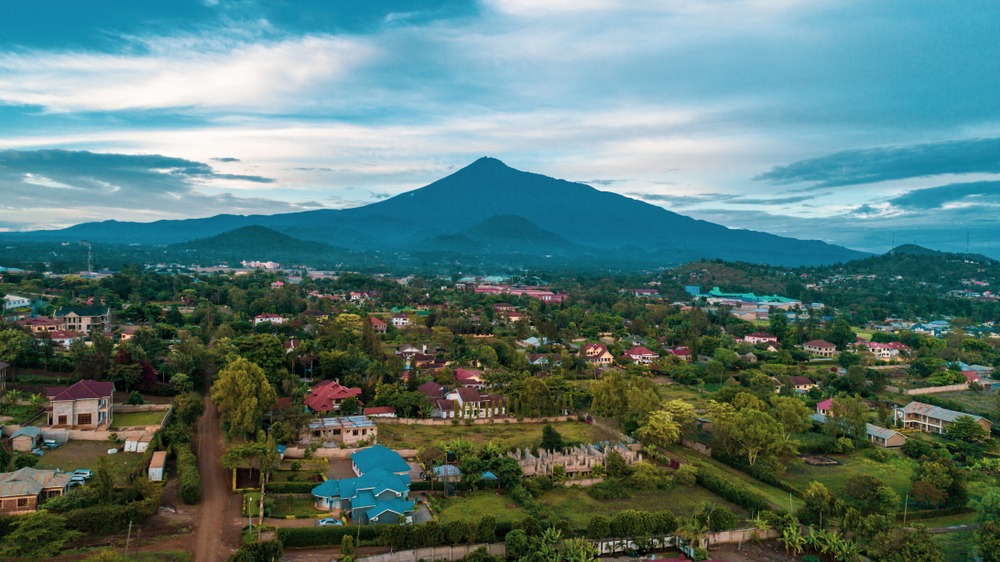
Located at the foot of Mount Meru, Arusha National Park is the only place in Tanzania where you can observe black and white Colobus monkeys. Ngurdoto Crater is home to wetlands frequented by buffalo and warthogs. The Momela Lakes, whose waters vary from blue to green depending on their mineral composition, welcome aquatic birds and Defassa waterbuck antelope.
The park lends itself to both hiking and 4x4 safari, with sightings of giraffes, impalas, hyenas and, more rarely, leopards.
Lake Manyara National Park
Set against the rift escarpment, Manyara park combines primary forest and an alkaline lake that occupies nearly two-thirds of its area. The track first crosses dense jungle populated by primates and antelope, then emerges onto plains traversed by wildebeest, zebras and buffalo. Manyara is renowned for its tree-climbing lions, a rare behaviour elsewhere.
Along the lake's shores, pink flamingos give the water a characteristic hue. The Rift Valley Photographic Lodge, perched on the escarpment, offers a commanding view of the park and the valley.
Ngorongoro Crater
Ngorongoro Crater is the world's largest intact caldera: 260 km² of surface area, approximately 18 km in diameter, with edges reaching 2,285 m. Its formation results from the collapse of an ancient volcano whose activity is linked to regional rifting.
The floor of the caldera concentrates over 30,000 animals according to surveys, including the black rhinoceros. Lake Magadi, alkaline in nature, attracts pink flamingos, pelicans and hippopotamuses. The descent is made by 4x4 from the rim, with an unobstructed view of the entire crater.
Lake Eyasi and the Hadzabé
The shores of Lake Eyasi are inhabited by the Hadzabé, one of Africa's last hunter-gatherer peoples. They live without fixed settlement, hunt small game with bows and supplement their diet with fruits and roots. Organised visits allow you to join a group on an early-morning hunt.
Lake Natron
Lake Natron takes its name from natron, a mineral abundant in its highly alkaline waters. In the dry season, evaporation reveals characteristic cracked ground. It is the main breeding site for lesser flamingos in East Africa, which gather by the tens of thousands. The area lends itself to hiking, notably towards Engare Sero Falls and Ol Doinyo Lengaï.
Practical information
Altitudes vary greatly along the Tanzanian rift: approximately 960 m at Lake Manyara, 1,100 m at Lake Natron, 2,285 m on the Ngorongoro rim. These variations create marked temperature differences between valleys and highlands: plan for warm clothing for nights at altitude.
As for depth, Lake Tanganyika, on the western branch, exceeds 1,470 m, making it one of the world's deepest lakes. A 4x4 vehicle remains essential for park tracks and secondary access routes.
When to visit
The dry season, from June to October, is the best time to explore the Tanzanian rift: wildlife concentrated around waterholes, passable tracks, clear visibility. December to February also offer reasonable conditions, with higher temperatures. The rainy season, from March to May, should be avoided: degraded roads in the parks and more difficult animal observations.
How to get there
International air access is via Kilimanjaro Airport (JRO) or Dar es Salaam Airport (DAR). From France, allow 8 to 12 hours of flight time with a stopover in Amsterdam, Istanbul or Addis Ababa. Local airlines Precision Air and Coastal Aviation serve airstrips near the parks, including Lake Manyara Airstrip.
By road, the A104 crosses the rift over approximately 150 km from Arusha and provides access to Manyara and Ngorongoro. From Dar es Salaam, allow approximately 650 km via the B1 then the A104, or about 8 hours of travel. Driving at night is not recommended in mountainous areas.
Nearby
Several Tanzanian sites complement a circuit in the rift:
- Arusha: gateway to the rift and logistical base for northern safaris.
- Lake Tanganyika: on the western branch of the rift, one of the world's deepest lakes.
- Barranco Hut Camp: key staging post for climbing Mount Kilimanjaro, near the eastern rift.
- Amboni Caves: the most extensive karstic network in East Africa.
Frequently asked questions
Frequently asked questions
The East African rift originates in the Afar Depression, in Ethiopia, near the Gulf of Aden. It extends south to the Zambezi Valley, in Mozambique. To the north, its system of faults extends to the Dead Sea.
Altitudes vary greatly: approximately 960 m at Lake Manyara, 1,100 m at Lake Natron and 2,285 m on the rim of Ngorongoro Crater. These variations create distinct microclimates.
The depressions reach several hundred metres below the surrounding plateaus. On the western branch, Lake Tanganyika exceeds 1,470 m in depth, making it one of the world's deepest lakes.
The dry season from June to October offers the best conditions for wildlife observation and travel. The rainy season from March to May should be avoided.
Surveys suggest over 30,000 animals in the caldera, including a resident population of black rhinoceros, a rare species in East Africa.
Preparing your journey
To incorporate the Great Rift Valley into a tailored circuit combining Ngorongoro, Manyara and Lake Natron, consult our itineraries in Tanzania travel.
Interested in this visit?
We can include it in your personalised itinerary.